Download Maps
Public Land Access:
• SMR-POA Public Land Access Map
Lands Included:
• SMR-POA Lands Map
Owners Map:
• SMR-POA Owners Map
SMR-POA Maps
Three (3) versions of the SMR-POA map are available to view below or download from the sidebar on the right. These are representations only and cannot be used as a substitute for land surveyors’ plats to exactly locate property lines. The Public Access Map provides GPS coordinates at the interfaces between private properties and public lands.
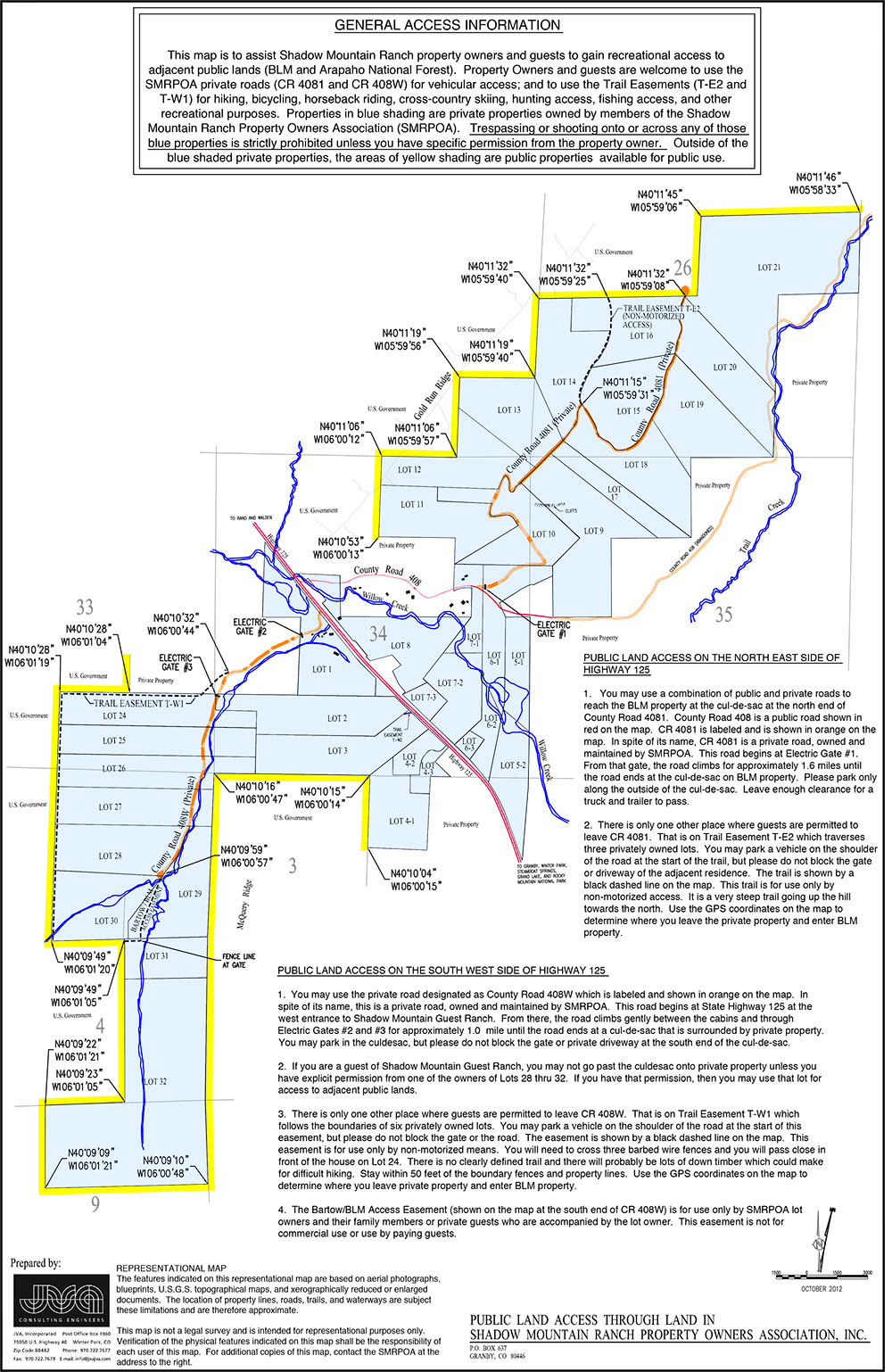 Public Land Access: This map shows public land access through Shadow Mountain Ranch Property Owners Association. Download this map from the sidebar.
>> View the SMR-POA Public Land Access Map
 Lands Included in SMR-POA: This map shows lands included in Shadow Mountain Ranch Property Owners Association. Download this map from the sidebar or click the image or following link to view the map in a new window.
>> View the SMR-POA Lands Map
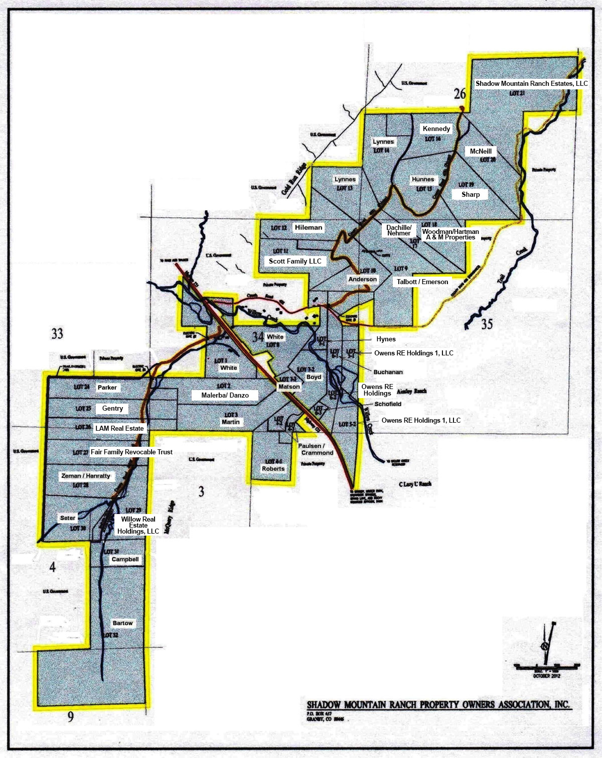 Owners in SMR-POA: This map shows owners of each lot included in Shadow Mountain Ranch Property Owners Association. Download this map from the sidebar or click the image or following link to view the map in a new window.
>> View the SMR-POA Owners Map